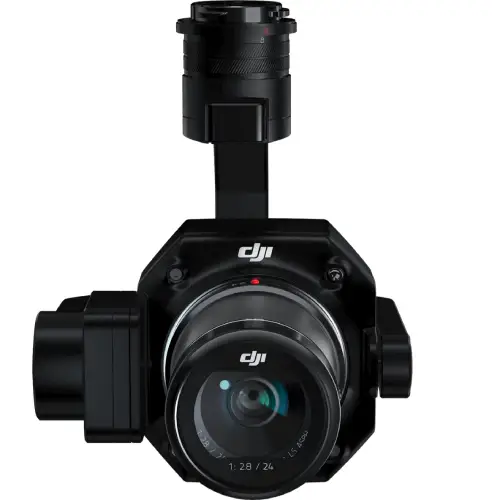
DJI Zenmuse P1
The New Benchmark for Aerial Surveying
The DJI Zenmuse P1 integrates a full-frame sensor with interchangeable fixed-focus lenses on a 3-axis stabilized gimbal. Designed for photogrammetry flight missions, it takes efficiency and accuracy to a whole new level.
DJI Zenmuse P1
The DJI Zenmuse P1 integrates a full-frame sensor with interchangeable fixed-focus lenses on a 3-axis stabilized gimbal. Designed for photogrammetry flight missions, it takes efficiency and accuracy to a whole new level.

The Go-to Tool for Aerial Photogrammetry

Extraordinary Efficiency with the P1
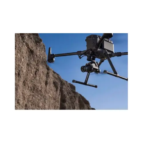
The DJI Zenmuse P1 includes a full-frame, low-noise high-sensitivity sensor that can take a photo every 0.7 s during the flight, and covering 3 km in a single flight. It is the ideal payload for the M300.

Remarkable Accuracy
Equipped with a global mechanical shutter and the all-new TimeSync 2.0 system, which synchronizes time across modules at the microsecond level, the DJI Zenmuse P1 lets users capture centimeter-accurate data combined with the real-time position and orientation compensation technology.

Robust Versatility
Create 2D, 3D, and detailed models thanks to the integrated 3-axis gimbal in the DJI Zenmuse P1 that can be outfitted with 24/35/50mm lenses and the Smart Oblique Capture feature.
Efficiency to Cover It All
Full-frame Camera
– 45MP Full-frame Sensor
– 4.4μm Pixel Size
– Low-noise, high sensitivity imaging extends daily operational time
– Take a photo every 0.7 s during the flight
– TimeSync 2.0 aligns the camera, flight controller, RTK module, and gimbal at the microsecond level

Smart Oblique Capture
Cover 7.5 km in a single workday with the P1. Elevate the efficiency of your oblique photography mission using Smart Oblique Capture, where the gimbal automatically rotates to take photos at the different angles needed. Only photos essential to the reconstruction will be taken at the edge of the flight area, increasing the efficiency of post processing by 20% to 50%.
Fieldwork Report
Verify data quality immediately post-flight by checking the position data and number of the images acquired, as well as RTK status and positioning accuracy
Reviews & Ratings
Related products

DJI Matrice 300 RTK

M300 propeller

Matrice 30T

Mavic 3 Enterprise Series

DJI AGRAS T30 INTELLIGENT BATTERY

M30 Propeller

Matrice 30

DJI Phantom 4 RTK

Autel Smart Controller V2

DJI AGRAS T10
Product Queries (0)
Login or Registerto submit your questions to seller
Other Questions
No none asked to seller yet
Top Selling Products


DJI MINI 3 COMBO PLUS

DJI Mavic 3 Classic with RC

DJI MINI 3 Pro With DJI RC

DJI MINI 3 Pro
Top Selling Products
DJI MINI 3 COMBO PLUS
DJI Mavic 3 Classic with RC
DJI MINI 3 Pro With DJI RC
DJI MINI 3 Pro
About
Contacts
-
Address
Office 203, Al Tayer Commercial Building, Rolla Street, Bur Dubai, UAE
-
Phone
+9714 2238380 / +97150 157 6093
-
Email
-
Whatsapp
My Account
Customer Service
Subscribe to our newsletter for regular updates about Offers, Coupons & more
Follow Us
-
Address
Office 203, Al Tayer Commercial Building, Rolla Street, Bur Dubai, UAE
-
Phone
+9714 2238380 / +97150 157 6093
-
Email
-
Whatsapp